
Lexington is one of the finest extant examples of a typical 19th century county seat in terms of history, architecture, and surroundings. The Historic District encompasses virtually the entire city limits. A walking tour brochure is available from any of the downtown merchants and on the door at City Hall.

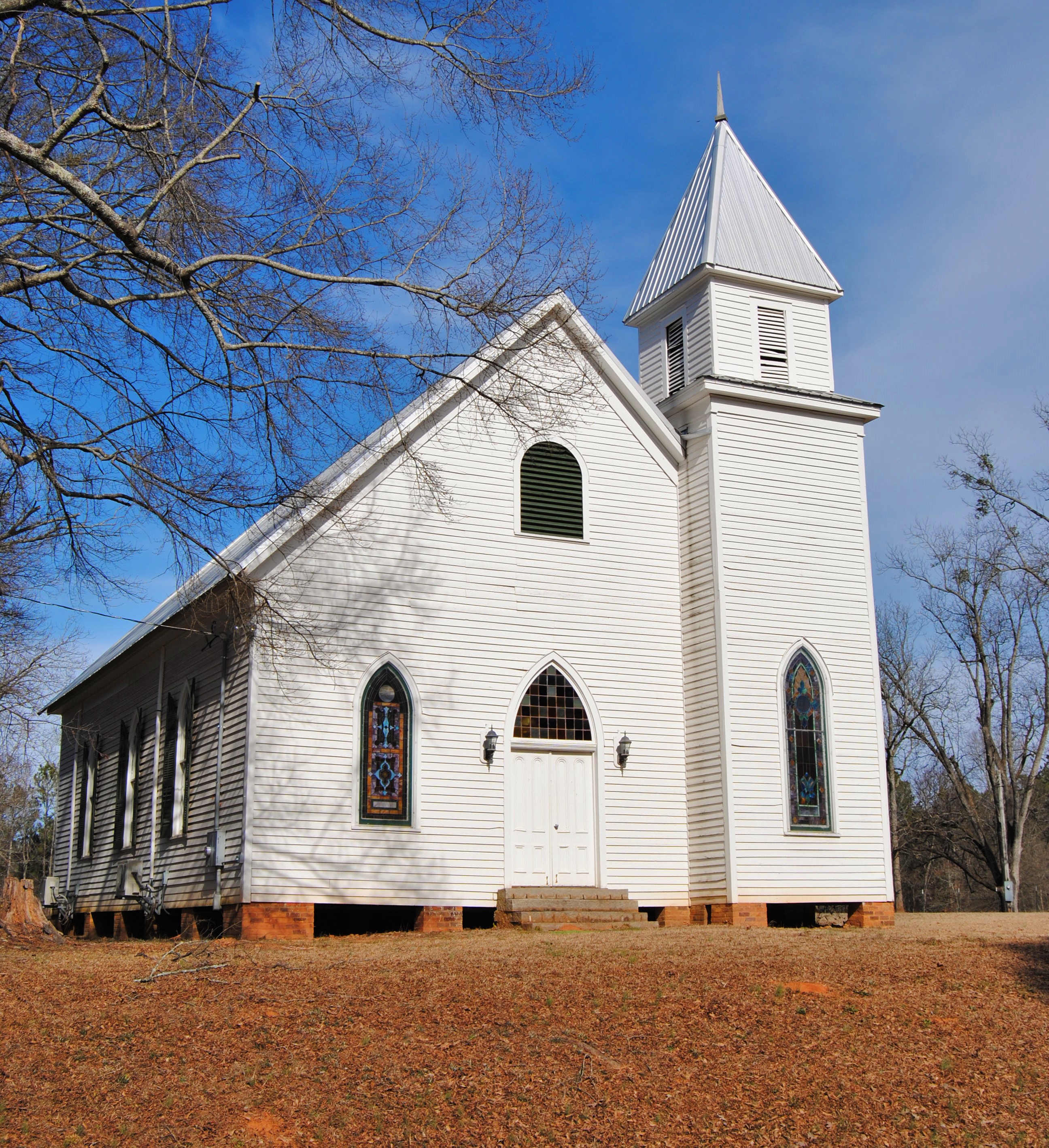
Beth Salem Presbyterian Church and Manse
The Beth Salem Presbyterian Church and Manse is one of Georgia’s oldest and most prominent rural churches, organized by John Newton in 1785, and located in Historic Downtown Lexington. The Church, Manse and neighboring park can be rented, per hour, at a minimal cost. Please contact our Mayor, Evelyn Reece, for more information: Mayor@lexingtonga.org
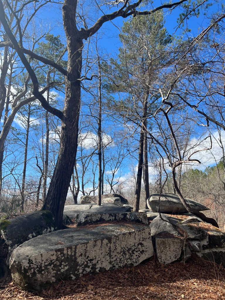
Shaking Rock Park
Located near the southern edge of Lexington, this unusual park features huge natural granite outcroppings in unusual shapes scattered throughout the park. An enormous 20-ton boulder, so perfectly balanced that it can be shaken with the pressure of one hand, gives the park its name. The park is complemented by an active beaver pond and nature trails and was once part of Governor George R. Gilmer’s estate.
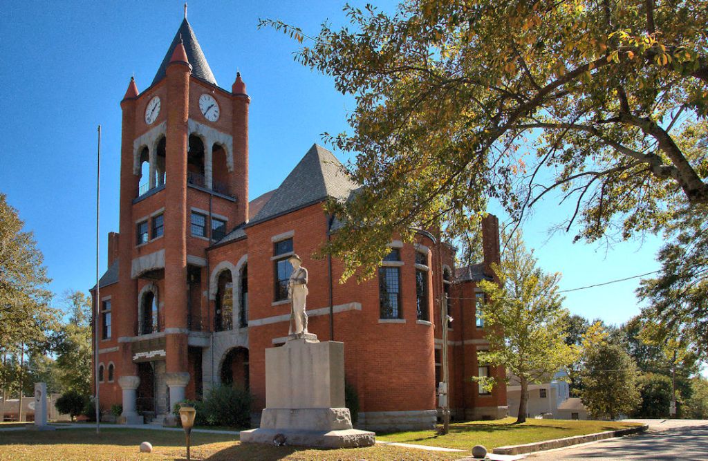
Oglethorpe County Courthouse
The Oglethorpe County Courthouse has a history that spans from a log structure built in 1793 to the current Romanesque Revival-style building completed in 1887.
Smithonia National Register Historic District
This district includes a portion of the James Monroe Smith plantation known as “Smithonia”. It was an empire that covered over 20,000 acres with over 3000 workers. It had two railroads, a hotel, mills, factories, streetlights, and stores. To reach the district, turn at the red light in Crawford. This road passes between the recently restored plantation house and the brick barns, previously restored by singer, Kenny Roge.
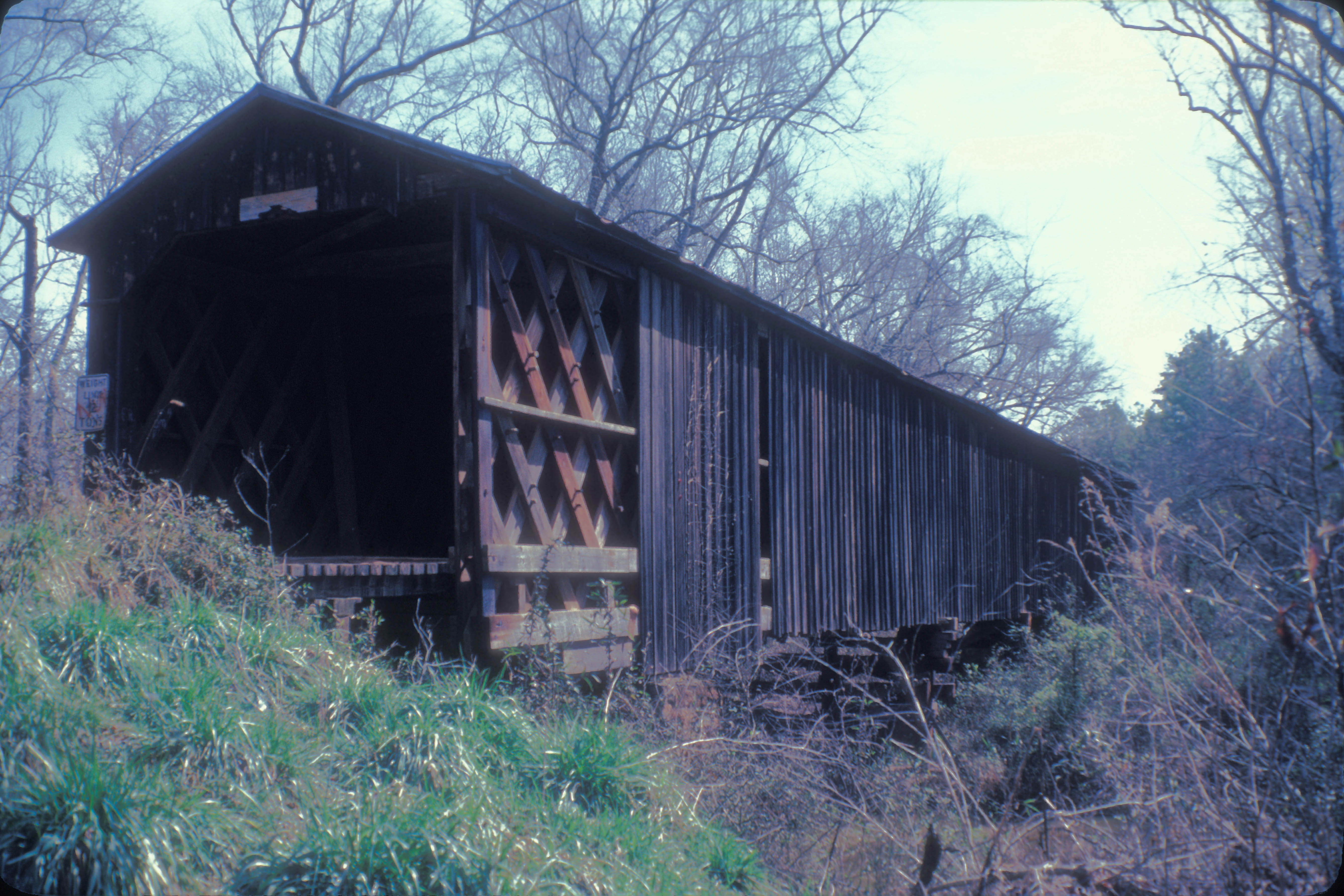
Big Clouds Creek Covered Bridge
Built in 1904 -1905, this is the longest single span covered bridge in Georgia. Jim Smith’s railroad brought the wood in for the construction. It is built in the Town Lattice design and is one of only eleven covered bridges left in the state. It was placed on the National Register of Historic Places in 2002.
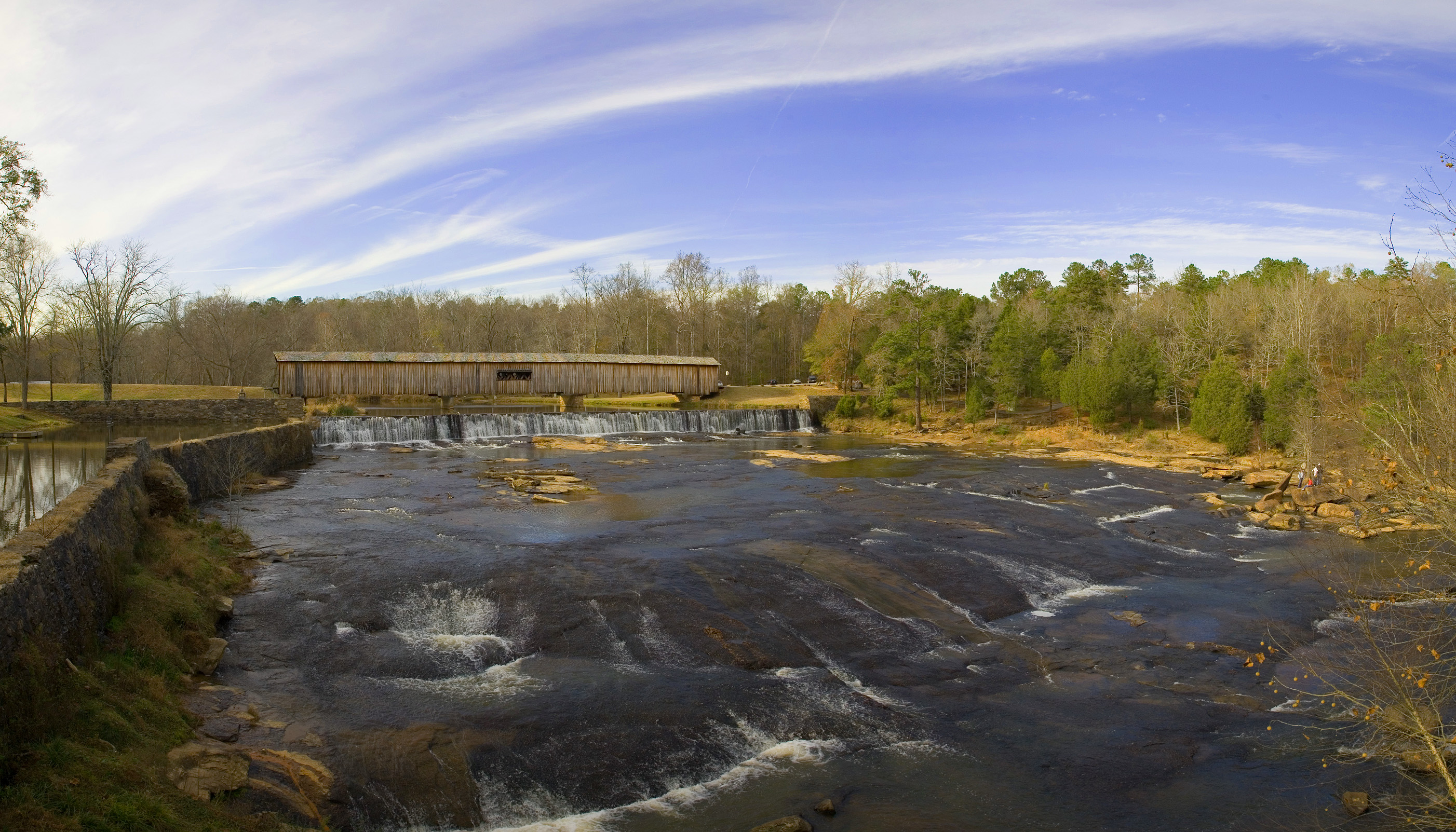
Watson Mill Covered Bridge
The longest original site covered bridge in Georgia is located in one of the most picturesque state parks in Georgia and spans 229 feet across the South Fork River. Built in 1885 by, the bridge is supported by a Town Lattice truss system held together with wooden pins. The Town Lattice design was created by builder W. W. King, the Georgia-born son of a freed slave. The bridge is listed on the National Register of Historic Places. There are campgrounds, hiking and nature trails, bike and horse trails, fishing and canoeing, a picnic area and wonderful rock filled shoals for a cooling dip in the hot summer heat.
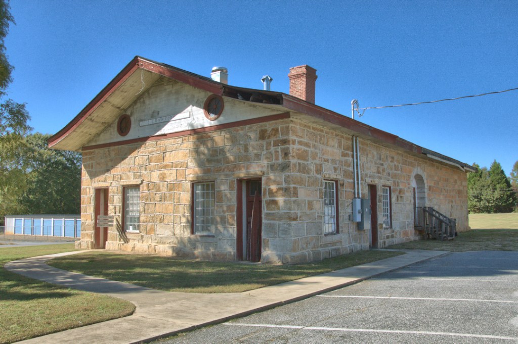
The Old Crawford Depot
This outstanding mid-nineteenth century granite structure , on the National Register of Historic Places since 1977, was built in 1848, replacing the original wooden structure. Stone used in the construction of the depot were the original railroad cross ties, quarried in Lithonia, GA. This depot has the distinction of being the last remaining stone depot built by the Georgia Railroad. It was used for ammunition storage during the War Between the States. It was originally Lexington Depot, located several miles to the west of the city because the citizens objected to the railroad coming any closer to their town. The town of Crawford, built on part of the land grant of William H. Crawford, grew up around the depot.
Cherokee Corner
Located between the county line and Arnoldsville on Highway 78, is an historical marker dedicated to the settlement of boundary lines for the Cherokee and Creek Indian tribes who were the original inhabitants of this area. After the Treaty of 1773, Cherokee Corner marked a corner in the supposed boundary line between Indian Territory and the State of Georgia. Cherokee Corner was, for many years, a stagecoach stop, trading post and post office.
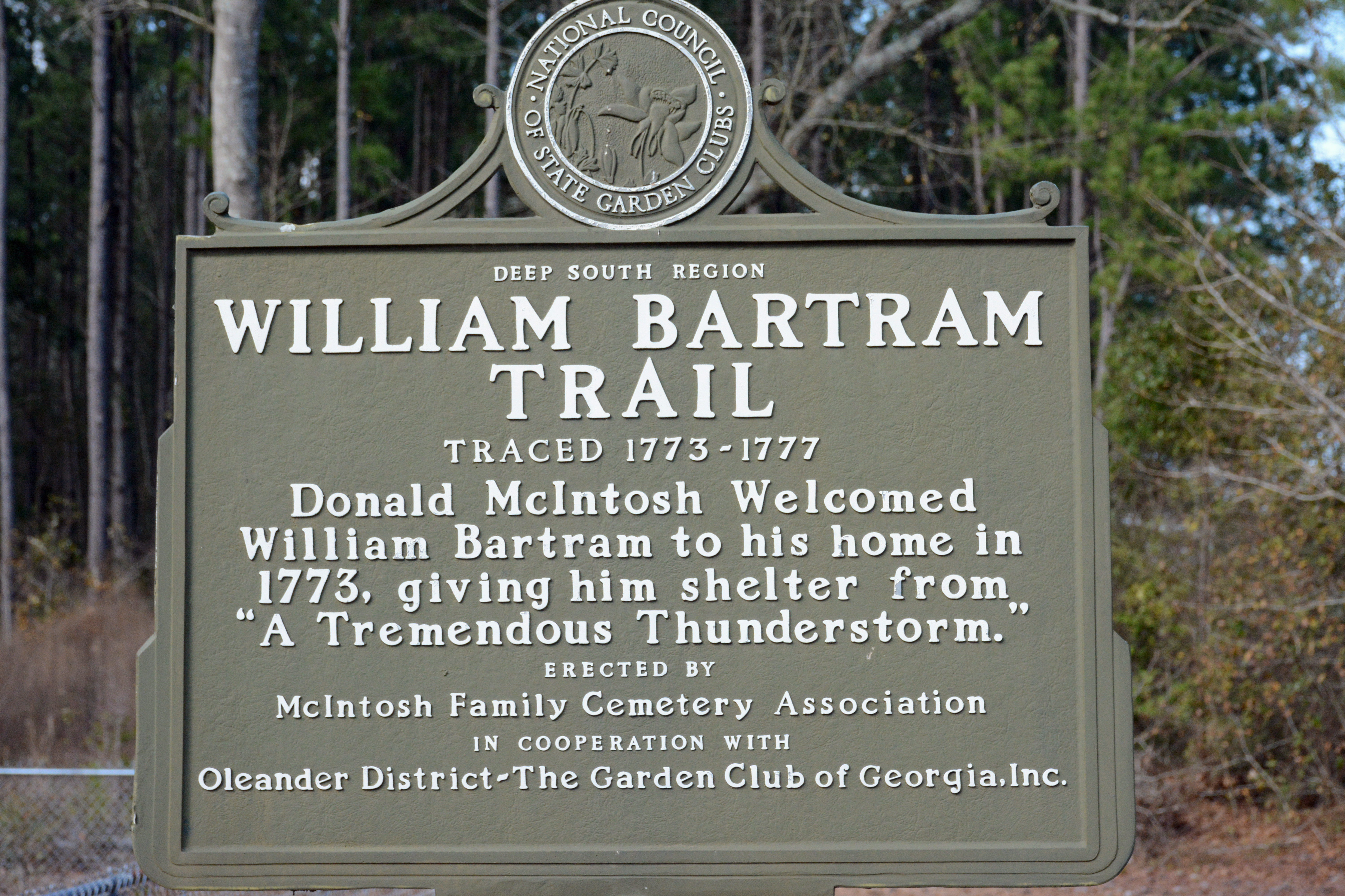
The Bartram Trail
Immediately after the Treaty of 1773 was signed, William Bartram, the famous naturalist, accompanied the team dispatched from Augusta to survey the boundary and explore the new territory. Bartram kept a journal of what he saw along the way, including the Great Buffalo Lick near Philomath. The journal, including notes on his explorations of Georgia, Florida and the Carolinas, was published as “Travels” in 1791 and his route became known as The Bartram Trail. The trail runs through the heart of Oglethorpe County from Philomath to Cherokee Corner.
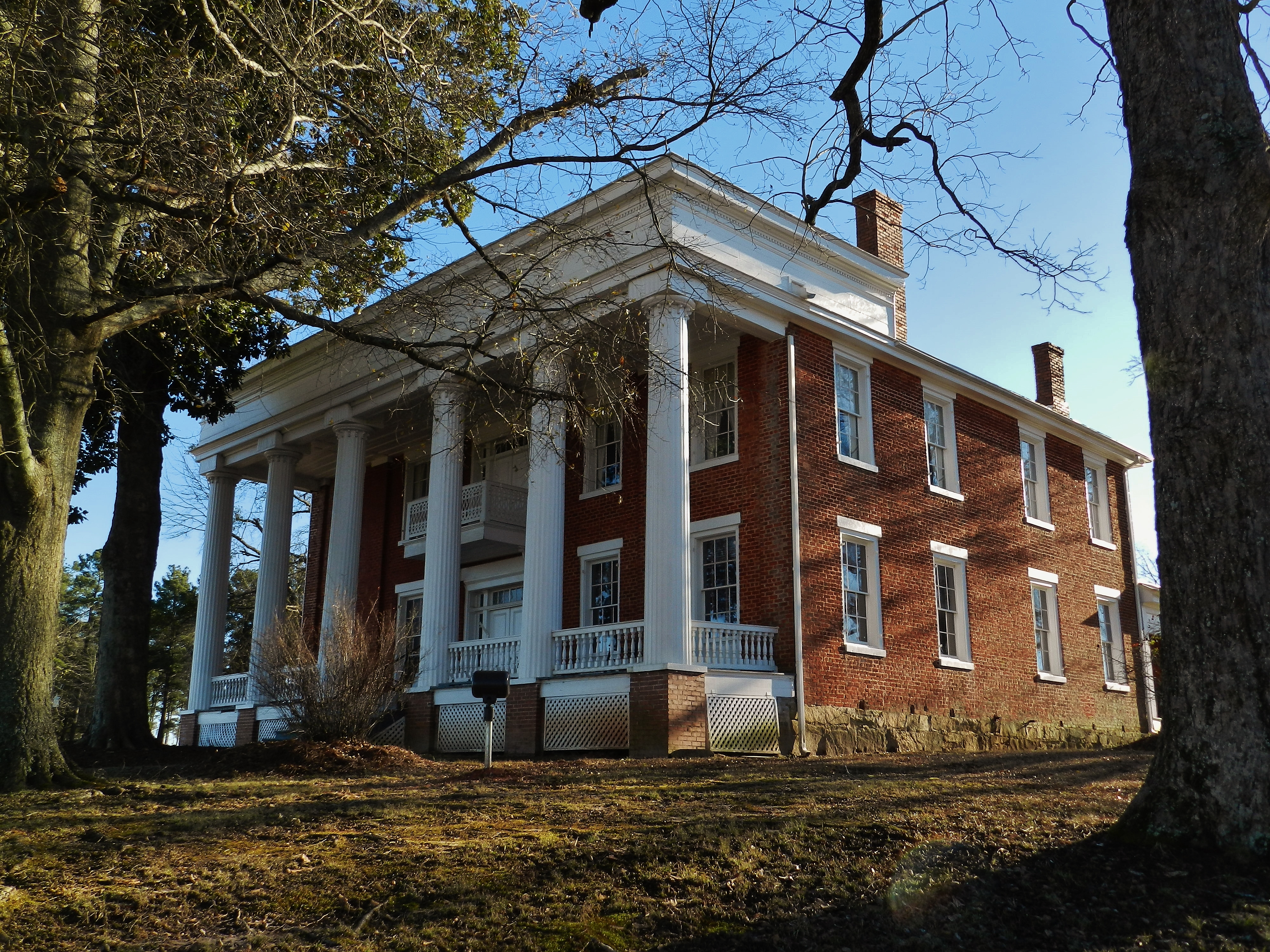
Callaway Plantation
Located on Highway 78 East in adjacent Wilkes County, this marvelous restoration offers representations of like in the various periods of area history.
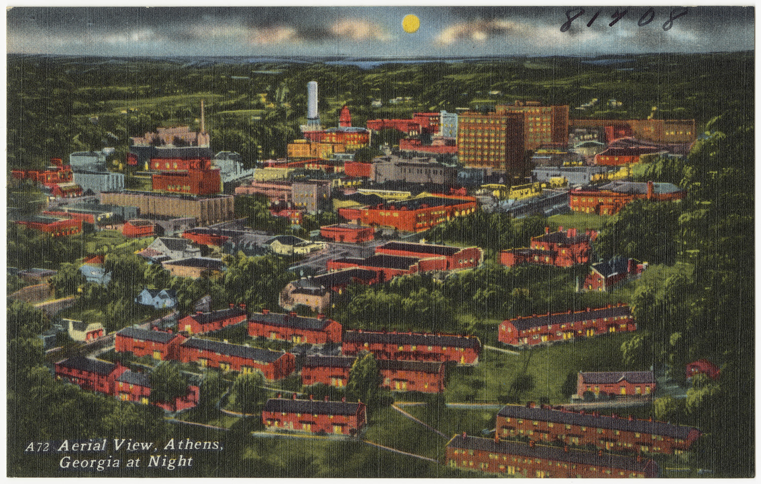
University of Georgia & Athens
Just 15 minutes west of Lexington is the “Classic City”, home to the Georgia Bulldogs, State Botanical Gardens of Georgia, the 131 acre Sandy Creek Nature Center and The Ladies Garden Club, the first garden club in the United States.
Directions to Lexington
From I-20 (from SC), exit right on Highway
78 W at Thomson, follow highway 78 W to Lexington.
From I-85 (from SC), exit right onto Highway 441 at Commerce. Proceed South on 441 to Loop 10E. Enter Loop 10 East and proceed to Exit 8 (Lexington Road ). Exit right onto Hwy 78 (Lexington Road) and proceed 17 miles to Lexington.
From I -85 North (from Atlanta), Hwy 316 to Athens, exit right onto Loop 10, Exit right at Exit 8 (Lexington Road), proceed 17 miles to Lexington
From 1-20(from Atlanta), Exit North at Highway 138 in Conyers, proceed 16 miles and segue onto 78 East, proceed 16 miles to light and turn right onto Hwy 316, exit right onto Loop 10, Exit right at Exit #8 (Lexington Road) proceed 17 miles to Lexington.
